
Trees snapped in half. Power out for days.
On the night of Thursday, Aug. 24, multiple tornadoes struck Northeast Ohio leaving rubble scattered all over the streets.
A total of 12 tornadoes in Northeast Ohio were confirmed by the National Weather Service. Some of these locations include Midtown Cleveland, Mentor, Warrensville Heights and Bainbridge, according to the National Weather Service.
“We knew there was a high severe weather threat that day, and we knew there was a potential for tornadoes,” WKYC’s Senior Meteorologist Matt Wintz said. “But the way that line [of storms] evolved as it moved in; there were five or six notches on that line, which I’ve never seen here locally, where each of those likely had a tornado from it.”
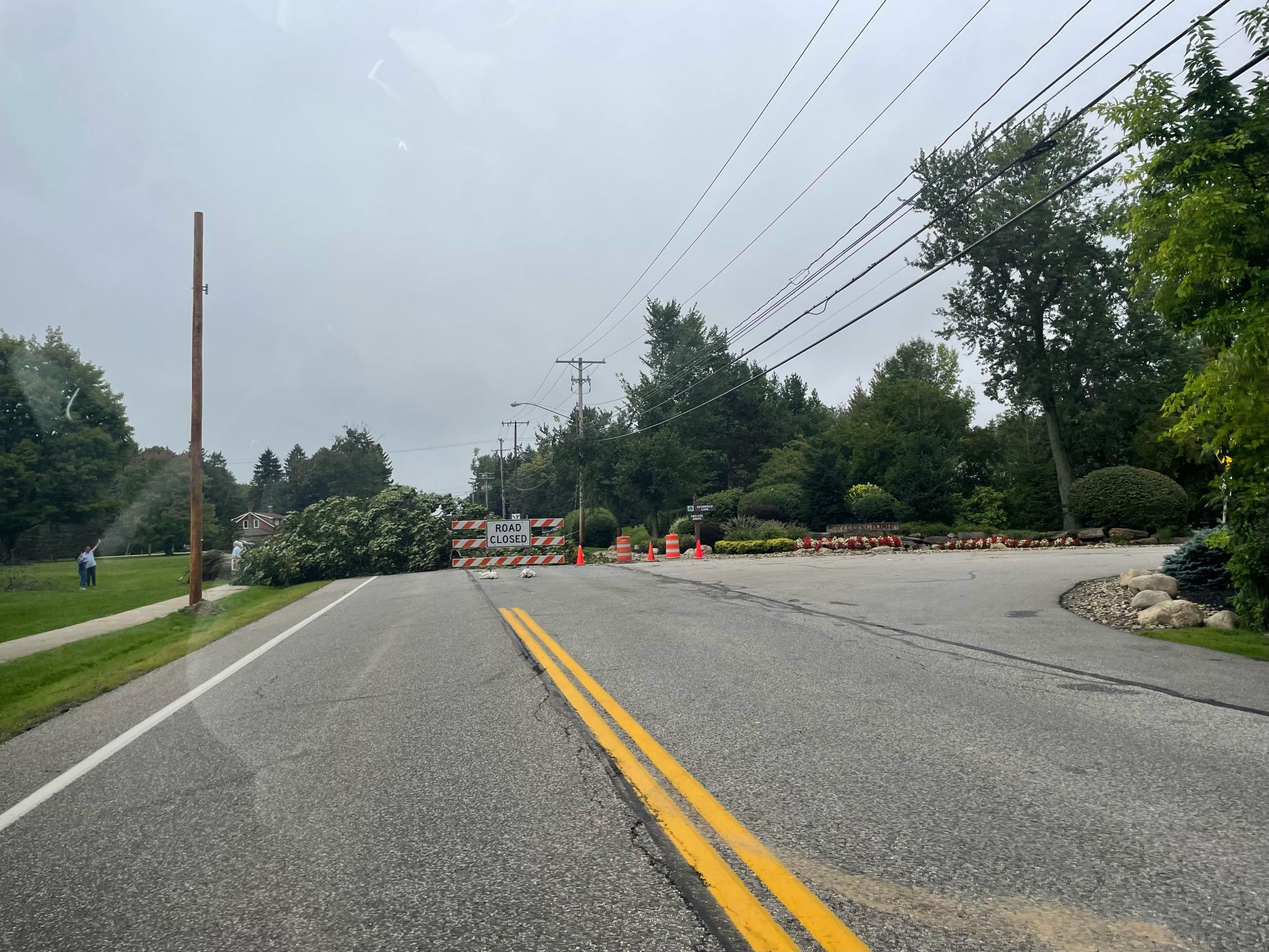
While there was no confirmed tornado in Beachwood, ferocious winds snapped multiple trees in half and bent a power pole on Fairmount Boulevard. This caused the Beachwood Police Department to close the westbound lanes of Fairmount Boulevard between Richmond Road and Deborah Drive on Friday, Aug. 25, as crews worked to solve the issue.
Senior Probir Mukherjee mentioned that the Fairmount Boulevard road closure made it hard to get around.
“I woke up at around midnight and the lights in my house were flickering,” he said. “Definitely a scary experience.”
Orchestra Teacher Allison Siekmann was also surprised at the extent of the damage.
“I was shocked when I drove through Cleveland Heights, Shaker Heights, and Beachwood that day,” she wrote in an email. “There were so many trees split in half, branches down, and even trees uprooted.”
“Living in Cleveland Heights, my home did not experience significant storm damage other than a few branches down in the yard,” she wrote in an email. “I was lucky enough to only lose power for about 15 minutes overnight before it came back on but neighbors even two blocks away did not have power for about a day and a half after the storm.”
According to the National Weather Service, the Warrensville Heights tornado was measured as an EF-2, with winds peaking at 120 mph. The tornado carved a path starting near Green Road, moving across the I-271 and I-480 interchange and ending at Galaxy Parkway.
It caused extensive roof damage to industrial buildings, power lines and even a car dealership.
Another tornado occurred on the same night in Midtown Cleveland, which was the first tornado to touch down in the Cleveland city limits since 1992, according to Cleveland 19.
Wintz stated that this event was not predicted to be as impactful as it was.
“We knew there was a high severe weather threat that day, and we knew there was a potential for tornadoes,” he said. “But the way that line [of storms] evolved as it moved in; there were five or six notches on that line, which I’ve never seen here locally, where each of those likely had a tornado from it.”
Wintz also stressed the importance of directional shear in forming tornadoes, which is when the wind direction differs with height in the atmosphere.
“Wind has to go from hitting you in the face here on the ground to a different direction up in the clouds,” he said. “If you get clouds and thunderstorms to develop, they go up into the sky. And so all of a sudden that cloud that’s growing is also churning with the wind [due to directional shear].”
Wintz explained that speed shear is also critical in the development of tornadoes, which is when the wind speed increases with height.
Wintz explains that “[the wind] goes faster up at the top [of the atmosphere], so that creates a rolling effect as that cloud continues to try to sustain itself.”
On Aug. 24, directional and speed shear were the primary cause of the dozen tornadoes that touched down in the area.
“There are times when you have shear and you don’t have tornadoes,” he said. “On a calm day you can have wind shear, but if [those tornado ingredients] line up perfectly, [tornadoes can break out].”
According to National Geographic, the specific tornado ingredients Wintz referred to, other than directional and speed shear, are warm, moist air, and an unstable atmosphere.
Due to rising global temperatures, more water vapor is getting released into the atmosphere.
“Because…our oceans are warmer, we’re throwing more water vapor into the atmosphere,” Wintz said. “When we throw more water vapor in the atmosphere, we can have heavier rain events. It rains more frequently. We can have more clouds.”
Wintz stressed that increased water vapor is affecting Northeast Ohio weather.
“Locally, there’s more water vapor [in the atmosphere] and that’s messing with things so we can get more flooding,” he said.
Climate change may also be lengthening the storm season.
“We had tornadoes in August, and August is typically a month where you don’t have the Jet Stream involved [and] it’s usually the doldrums weather-wise,” he said. “We’ve had some events in November the last couple years. And so, to me, we can have a tornado any month of the year now.”
Wintz acknowledges that there are debates surrounding climate change, but says the evidence is clear that the earth is getting warmer.
Contributing to this issue, summer 2023 was the hottest season the world has ever experienced, according to Reuters.
The NASA Earth Observatory recorded July 2023 as the hottest month on record, which surely contributed to the ferocity of the August tornadoes.
Wintz states that the August tornado outbreak was an incredible event for him.
“The reason why it was memorable for me was because we saw the the development of those tornadoes out over the lake,” he said. “And it was before the National Weather Service even issued anything.”
“[WKYC meteorologists] were telling the viewers [that] there should be a tornado warning for this before they even issued [it] and it came right over our station,” he said
“There’s a pipe [at the station]…that starts whistling if the wind gets strong outside, and it started whistling [when the storms rolled through] and my ears popped,” he said. “It was the weirdest thing…and a tornado touched down about 1.9 miles from here.”


![“Even if you get surgery and there's no evidence of disease left, whenever they do a follow-up scan, there's always going to be anxiety,” said McClelland. “They even have a term [for it]. They call it ‘scanxiety.’”](https://bcomber.org/wp-content/uploads/2025/12/impact-of-cancer-1200x1200.jpg)